
Knoxville Greenway System for Dog Walkers: Complete Network Guide

TLDR: The Knoxville Greenway System for Dog Walkers provides 90+ miles of interconnected paved trails across Knox County, ranging from the 2.5-mile Neyland loop perfect for beginners to the 8.5-mile Will Skelton route challenging athletic dogs. Major corridors include Third Creek (9.8 miles), Will Skelton (8.5 miles), Neyland (2.5 miles), and Baker Creek (2.8 miles), all featuring marked access points, parking, and rest areas. Start with the Neyland Greenway's flat loop to assess your dog's endurance before exploring longer, more challenging routes.
Knoxville's interconnected greenway network delivers over 90 miles of paved, multi-use trails winding through the city's most scenic corridors, offering dog owners safe, leash-required paths for walking, jogging, and biking adventures with their pups. These accessible routes connect parks, neighborhoods, and natural areas through a continuously expanding system that ranges from flat riverside trails perfect for senior dogs to rolling terrain that challenges athletic breeds. Understanding which greenways connect, where to access the network, and how to design custom routes matching your dog's fitness level transforms these paved paths into your go-to training grounds for urban dog exercise and daily enrichment throughout the year.
Understanding Knoxville's greenway network and how it works
Knoxville's greenway system operates under Knox County Parks and Recreation management, creating an interconnected network of paved, ADA-accessible trails averaging 10-12 feet wide that accommodate pedestrians, cyclists, and leashed dogs simultaneously. The system currently spans approximately 92 miles with plans for continued expansion, connecting over 30 parks, natural areas, and public spaces across the county. Most greenways follow creek beds, river corridors, and former railway lines, providing relatively flat terrain with gentle grades rarely exceeding 5% that suit dogs of all ages and fitness levels.
All greenways enforce leash requirements (maximum 6-foot leash), remain open from dawn until dusk year-round, and prohibit motorized vehicles except mobility devices. The paved surface stays in excellent condition thanks to regular maintenance, with most sections recently resurfaced creating smooth surfaces gentle on dog paw pads. Signage appears every quarter mile indicating your current location and distances to major connection points, helping you plan turnaround points for out-and-back routes or continue exploring when you're ready to extend your adventure.
The network divides into several major corridors: the Third Creek system running north-south through West Knoxville, the Tennessee River corridor following the waterfront downtown, the Will Skelton Greenway extending southeast toward Ijams Nature Center, and the newer Neyland Greenway circling the University of Tennessee campus. Secondary connectors link these main arteries, though some connections require brief street crossings marked with crosswalks and signage.
Major greenway corridors: distances, terrain, and highlights
Third Creek Greenway (North and South Sections, 9.8 miles total)
The Third Creek Greenway forms one of Knoxville's longest continuous greenways, running 9.8 miles from Fountain City in the north through West Knoxville to Sequoyah Hills in the south. This popular corridor divides into two distinct sections: the North Section (3.5 miles from Fountain City Park to Concord Park) and the South Section (6.3 miles from Concord Park to the Tennessee River). The entire route follows Third Creek through mature hardwood forests and residential neighborhoods, with the paved trail staying 10-12 feet wide throughout and shade coverage approaching 70% during summer months.
Starting from the northern terminus at Fountain City Park (5005 Jacksboro Pike), you'll find ample parking (40+ spaces) plus restrooms and water fountains operating April-October. This section climbs gently southward with approximately 180 feet of elevation gain spread across 3.5 miles, creating a moderate cardiovascular workout without overwhelming inclines. Two rest areas with benches appear at miles 1.2 and 2.4, perfect for water breaks with your dog before continuing.
The South Section beginning at Concord Park (11808 S Northshore Drive, parking for 60+ vehicles) offers flatter terrain with only 90 feet of elevation change across 6.3 miles. This stretch passes Westwood Park, Tyson Park, and Sequoyah Park, providing multiple access points where you can start shorter segments. Creek access points appear every half mile where water-loving dogs can wade under supervision, though the creek stays shallow (typically 6-12 inches) except after heavy rain.
Best for: Building distance endurance, shaded summer walks, multiple access points for flexible routes
Parking locations: Fountain City Park (north), Concord Park (central), Sequoyah Park (south)
Terrain: Paved, mostly flat with gentle rolling in north section
Average completion times: North section 60-75 minutes one-way, South section 100-120 minutes one-way
Rest areas: 6 locations with benches along full route
Connections: Links to Neyland Greenway via Sequoyah Park
Will Skelton Greenway (8.5 miles one-way)
The Will Skelton Greenway creates Knoxville's longest single greenway corridor, extending 8.5 miles from Island Home Park near downtown southeast to Forks of the River Wildlife Management Area. This scenic route parallels the Tennessee River for much of its length, offering water views and breezes that make summer walks more comfortable. The entirely paved trail maintains consistent 10-foot width, though the surface quality varies with older sections showing more wear than recently renovated portions.
Island Home Park (1900 Island Home Avenue, 50+ parking spaces) serves as the primary access point, offering restrooms, water fountains, covered pavilions, and direct connection to Ijams Nature Center trails. The first 2 miles remain completely flat as you follow the river, then gentle grades introduce approximately 120 feet of elevation gain over the next 4 miles. The final 2.5 miles level out again as you approach Forks of the River.
Multiple creek crossings occur via bridges, and the route passes through varied environments: riverside forests, open meadows, and wetland edges where wildlife sightings (herons, turtles, beavers) happen frequently during early morning or evening walks. The eastern terminus at Forks of the River provides primitive parking for 20 vehicles but lacks amenities, making Island Home Park the preferred starting location for most visitors.
Best for: Long-distance walks (17 miles roundtrip), wildlife viewing, riverside scenery
Parking locations: Island Home Park (west), Forks of the River (east, limited)
Terrain: Paved, mostly flat with gradual middle section
Average completion times: 2-2.5 hours one-way, 4-5 hours full roundtrip
Rest areas: 4 benches, limited shade in open sections
Connections: Direct link to Ijams Nature Center trail system
Neyland Greenway (2.5 miles loop)
The Neyland Greenway circles the University of Tennessee campus and Neyland Stadium, creating a 2.5-mile loop that's become one of Knoxville's busiest urban trails. This scenic riverside route delivers constant Tennessee River views as it follows the waterfront from Volunteer Landing downtown to the UT campus and back. The completely flat, well-maintained pavement makes this accessible for all fitness levels, though popularity means heavy foot and bike traffic especially during weekday mornings (7-9am) and evenings (5-7pm), plus game days when the trail becomes extremely crowded.
Parking options include Volunteer Landing downtown (300+ spaces in nearby lots), James White Parkway lots near UT (50 spaces), and Sequoyah Park connecting to the southern end. Multiple entry points allow creating shorter 1-mile or 1.5-mile out-and-back routes rather than completing the full loop. Benches appear every quarter mile, water fountains operate April-October at four locations, and excellent lighting extends usability into evening hours year-round.
The Neyland Greenway's urban location means less natural environment compared to creek-following greenways, but the river views and well-maintained amenities make this an excellent choice for dogs still building trail confidence or owners seeking shorter, convenient routes. Weekend mornings before 8am offer the least crowded conditions for reactive dogs who need more space from other trail users.
Best for: Short convenient loops, city views, evening walks with lighting
Parking locations: Volunteer Landing (downtown), UT campus lots, Sequoyah Park
Terrain: Paved loop, completely flat
Average completion time: 40-60 minutes full loop
Rest areas: 10+ benches around loop
Connections: Links to Third Creek Greenway at Sequoyah Park
Baker Creek Greenway (2.8 miles)
The Baker Creek Greenway in West Knoxville offers a quieter alternative to busier corridors, winding 2.8 miles through residential areas from Pellissippi State Community College to Ball Camp Park. This newer greenway features excellent pavement quality and thoughtful landscaping with native plantings that attract butterflies and songbirds during spring and summer. The route includes approximately 140 feet of elevation change distributed across gentle grades, creating moderate exercise without extreme climbs.
Pellissippi State (parking for 40+ vehicles off Ball Camp Pike) provides the northern access point with restrooms during college operating hours, while Ball Camp Park (parking for 60 vehicles) offers the southern terminus. The greenway passes through several small neighborhood parks where you can access water fountains and rest areas, making this convenient for creating shorter 1-1.5 mile segments if the full distance exceeds your dog's current endurance.
This greenway sees moderate traffic compared to downtown routes, making it a smart choice for building your dog's social skills around other trail users without overwhelming stimulation. Creek access points at two locations allow water-loving dogs to wade and cool off during warmer months.
Best for: Moderate crowds, neighborhood connectivity, shorter segments
Parking locations: Pellissippi State Community College (north), Ball Camp Park (south)
Terrain: Paved with gentle rolling
Average completion time: 50-70 minutes one-way
Rest areas: 3 locations with benches
Connections: Future connections to Third Creek system planned
South Knoxville Greenway (Planned: Tennessee River Bluffs, 1.8 miles)
The South Knoxville Greenway represents the system's newest addition, with the Tennessee River Bluffs section opening in phases through 2025. This 1.8-mile route will follow the river through South Waterfront and connect to downtown via pedestrian bridges, creating dramatic bluff-top views 60-80 feet above the Tennessee River. Initial sections opened in late 2024, with full completion scheduled for summer 2025.
The completed greenway will provide access from Suttree Landing Park (downtown connection) to South Waterfront, though parking and amenity details remain under development as of this writing. Check Knox County Parks and Recreation for current status before planning visits, as construction may affect access and routing.
Best for: Scenic river views, new trail exploration, downtown connections (when complete)
Parking locations: Under development, check current status
Terrain: Paved with moderate elevation changes following bluff contours
Status: Partial completion, full opening scheduled 2025
Access points and parking locations: where to start your greenway adventure
Strategic access point selection determines whether you complete an out-and-back route, a point-to-point journey with two vehicles, or a loop combining multiple greenway sections. Major parking areas with 40+ spaces include Fountain City Park (Third Creek North), Concord Park (Third Creek Central), Island Home Park (Will Skelton), Volunteer Landing (Neyland), and Ball Camp Park (Baker Creek). These primary trailheads offer restrooms, water fountains, and often covered pavilions making them ideal starting points for longer adventures.
Secondary access points with 10-20 parking spaces include Westwood Park, Tyson Park, Sequoyah Park, and various neighborhood connections. These smaller lots work perfectly for shorter segments or when primary lots fill during peak spring and fall weekend mornings. Most greenway parking remains free except downtown locations (Volunteer Landing charges $5-8 daily), though accessible parking spaces require proper permits at all locations.
Parking lot hours typically match greenway hours (dawn to dusk), though some parks like Sequoyah and Concord lock gates at sunset while others remain open with parking at your own risk after dark. Weekday mornings before 8am and weekday afternoons 1-3pm offer the least crowded parking conditions, while Saturday and Sunday mornings fill quickly March-November at popular trailheads like Island Home and Concord.
Creating custom routes: design your perfect distance and experience
Knoxville's greenway network supports infinite route combinations by mixing sections, utilizing connection points, and adding out-and-back segments. A 30-minute quick walk (1.5-2 miles roundtrip) works perfectly from any neighborhood access point—try Concord Park to Tyson Park on Third Creek (0.8 miles each way) or Neyland Greenway's half-loop from Volunteer Landing (1.2 miles). These shorter routes suit puppies building stamina, senior dogs, or lunch break exercise fitting into busy urban schedules.
60-90 minute moderate adventures (3-5 miles) can follow Third Creek North from Fountain City to Concord (3.5 miles one-way), explore Baker Creek full length (2.8 miles), or complete the Neyland Greenway loop with an extended Third Creek connection (approximately 4 miles total). These mid-distance routes provide excellent cardiovascular conditioning while staying manageable for most athletic dogs 12+ months old.
Half-day expeditions (6-10 miles) combine multiple sections: Island Home Park to Forks of the River and back on Will Skelton (17 miles), full Third Creek system north to south (9.8 miles), or creative multi-greenway loops connecting Third Creek to Neyland to Will Skelton via street segments (8-12 miles depending on route). These ambitious routes demand planning around water availability, rest breaks every 2-3 miles, and proper seasonal timing to avoid afternoon heat.
Early morning hours (6-8am) provide the best greenway experience regardless of route length: cooler temperatures year-round, fewer cyclists and joggers competing for trail space, better wildlife viewing opportunities, and calmer conditions for dogs still building confidence around trail users. Weekend afternoons see heaviest traffic, making weekday exploration preferable when your schedule allows.
Which greenway sections offer the most canine enrichment
Dogs experience enrichment through environmental variety, sensory stimulation, and novel experiences that engage their natural behaviors. The Will Skelton Greenway delivers exceptional enrichment thanks to diverse habitats—riverside forests, open meadows, wetland edges—creating constantly changing scents, sights, and sounds that keep dogs mentally engaged throughout the journey. Frequent wildlife encounters (birds, turtles, occasional deer) stimulate prey drive and observational behaviors, while the long distance challenges physical endurance.
Third Creek South Section excels at providing creek access for water-loving dogs, with shallow wading spots appearing every half mile where dogs can cool off and explore aquatic environments safely. The mature forest canopy creates a sensory-rich environment where dogs track squirrels overhead, investigate fallen logs, and experience seasonal changes dramatically—spring wildflowers, summer shade, fall leaves, winter visibility revealing new sight lines.
For dogs who thrive on social interaction, the Neyland Greenway's busy urban environment provides constant exposure to other dogs, joggers, cyclists, and general trail traffic that builds confidence and good leash manners through repeated positive experiences. The flat terrain and shorter distance mean you can focus entirely on training and socialization rather than managing challenging footing or long distances.
Baker Creek Greenway's newer landscaping with native plantings attracts diverse bird species and butterflies, creating visual stimulation and natural hunting behaviors as dogs track movement and investigate new scents. The moderate traffic level strikes an ideal balance—enough environmental complexity to stay interesting without overwhelming reactive or anxious dogs still building social confidence.
Seasonal considerations: year-round greenway strategies
Spring (March-May) brings ideal greenway conditions with moderate temperatures (55-75°F), blooming wildflowers, and active wildlife, though mud following rain can make trail edges messy for dogs who wander off pavement. Creek water levels run highest during spring, creating more dramatic water features but also faster currents requiring closer supervision at access points. Allergy season affects some dogs, so watch for excessive paw licking or face rubbing indicating environmental allergies triggered by pollen.
Summer (June-August) demands early morning or evening greenway visits as temperatures regularly exceed 85°F with high humidity making afternoon walks dangerous for brachycephalic breeds and heavy-coated dogs. Choose shaded greenways like Third Creek over more exposed routes, carry extra water (1 ounce per pound of dog weight for walks exceeding 45 minutes), and watch for signs of overheating. When temperatures prohibit outdoor exercise, explore indoor alternatives and creative solutions for maintaining fitness.
Fall (September-November) delivers perfect greenway weather with crisp mornings, lower humidity, and spectacular foliage displays along creek corridors. Greenways see peak usage during October weekends, so arrive before 8am for parking at popular trailheads or choose less-trafficked routes like Baker Creek. Shorter daylight hours mean planning earlier walks as most greenways lack lighting except Neyland.
Winter (December-February) sees quietest greenway conditions as many fair-weather users stay home, creating excellent opportunities for building distance with minimal distractions. Temperatures typically stay above freezing during daylight hours (average high 45-50°F), and most greenways rarely accumulate snow thanks to regular use and southern exposure. The main winter challenge involves shorter days requiring earlier walks, though Neyland's lighting extends evening options year-round.
Trail etiquette and safety for dog walkers
Greenway rules require dogs remain on leash (maximum 6 feet) at all times, positioned to your right side to allow cyclists and joggers to safely pass on your left. When you hear "on your left," move your dog to the right edge of the trail and maintain control as faster users pass. Never allow retractable leashes to extend across the full trail width, as cyclists traveling 15+ mph can't react quickly enough to avoid sudden obstacles.
Pick up and pack out all dog waste using bags (dispensers available at most major trailheads, though carrying backup bags prevents running out mid-walk). Dispose of bags in trash receptacles at access points rather than leaving them trailside "to pick up on the return trip"—forgotten bags create maintenance issues and unpleasant experiences for other users.
Keep your dog's vaccination records current and ensure flea/tick prevention, as greenways expose dogs to other animals and environmental parasites. Most greenways pass through areas where wildlife lives, so discourage your dog from investigating burrows, chasing squirrels off-trail, or disturbing waterfowl along creek corridors. These natural behaviors need redirection rather than punishment, helping your dog learn appropriate greenway behavior gradually.
Watch for cyclists approaching rapidly, particularly on blind curves around dense vegetation. Keep young puppies and unpredictable dogs on 4-6 foot standard leashes rather than retractable leads providing more precise control. If your dog shows reactive behaviors toward other trail users, work on building confidence through gradual exposure during low-traffic times before attempting busy weekend mornings.
Connecting greenways to other Knoxville dog activities
Knoxville's greenway system integrates seamlessly with the city's broader dog-friendly infrastructure, creating opportunities for multi-activity outings that maximize your dog's enrichment and exercise. The Will Skelton Greenway connects directly to Ijams Nature Center's 50+ mile natural surface trail network, allowing you to transition from paved greenway to dirt hiking trails for varied terrain and environmental complexity.
Several greenways pass within blocks of dog-friendly restaurants with patios, creating perfect post-walk relaxation spots. Third Creek Greenway South passes near downtown restaurants, Neyland Greenway adjoins the Market Square district, and Will Skelton sits minutes from Island Home area establishments where you can enjoy lunch while your dog rests after a long morning walk.
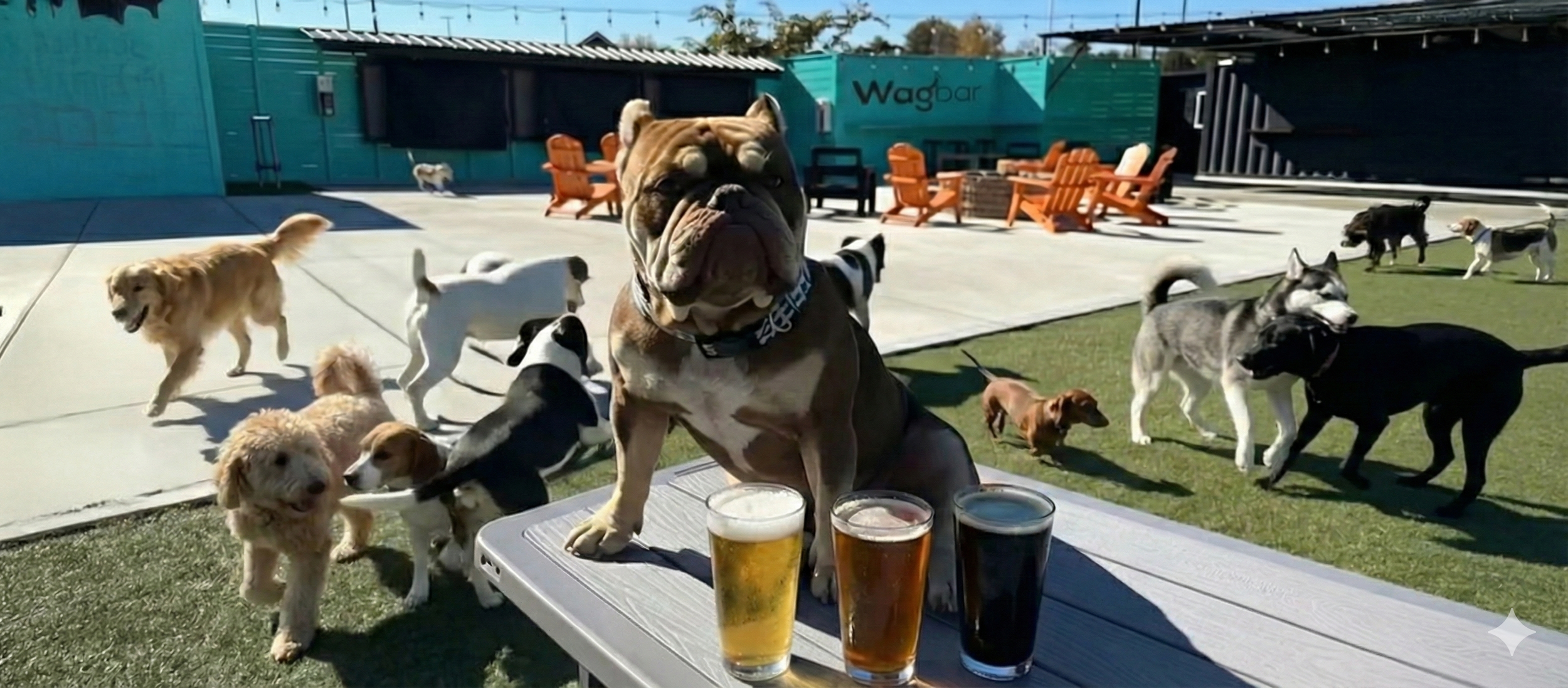
For dogs who've mastered greenway leash walking and crave off-leash freedom, Wagbar Knoxville offers a supervised off-leash dog park bar experience just minutes from major greenway access points. After building your dog's endurance and social confidence on the greenway network, graduate to off-leash play where dogs interact freely while owners relax with craft beverages in a safe, monitored environment—the perfect reward after consistently working on leashed exercise and training.
FAQ: Knoxville greenway questions answered
Are dogs allowed on all Knoxville greenways?
Yes, leashed dogs are welcome on all Knox County greenways year-round. All dogs must remain on leash (maximum 6-foot length) at all times, positioned to the right side of the trail to allow faster users to pass safely. Greenways operate under Knox County Parks rules requiring owners maintain control, clean up waste, and ensure dogs don't interfere with other trail users.
What are the busiest times on Knoxville greenways?
Peak traffic occurs weekday mornings (7-9am) and evenings (5-7pm) when local residents use greenways for commuting and exercise, plus Saturday and Sunday mornings (8am-noon) March-November. Early morning hours before 8am or weekday midday (11am-2pm) offer the quietest conditions. Neyland Greenway experiences extreme crowds during UT football game days—avoid those Saturdays unless your dog handles heavy congestion well.
Do I need to bring water for my dog on greenway walks?
Yes, always carry fresh water for walks exceeding 30 minutes, especially April-September. While some major trailheads offer water fountains, these operate seasonally (typically April-October) and aren't available along most trail sections. Plan for 4-6 ounces per mile for your dog's weight in cool weather, 8-12 ounces per mile in warm weather. Collapsible bowls fit easily in backpacks or clip to leashes.
Can I let my dog swim in creeks along greenways?
Dogs may wade in creek access points under close supervision, but owners assume all risk. Third Creek typically flows shallow (6-12 inches) and slow during summer, making it relatively safe for supervised wading, but water levels and currents increase dramatically after rain. Tennessee River access along Neyland and Will Skelton greenways is not recommended due to strong currents and boat traffic. Never allow dogs to drink creek water—carry fresh water instead.

Are greenways safe for walking dogs after dark?
Most greenways lack lighting and are officially open only dawn to dusk, making after-dark use not recommended. Neyland Greenway offers lighting throughout its loop, extending safe use into evening hours year-round. If you must walk at dusk, stay on well-lit sections near parking areas, use reflective gear for both you and your dog, and carry a flashlight. Consider indoor exercise alternatives during short winter days.
How do I know which greenway is right for my dog's fitness level?
Start with shorter, flatter routes if your dog is new to exercise, a puppy under 12 months, a senior, or recovering from injury. The Neyland Greenway loop (2.5 miles) and Baker Creek segments (1-2 miles) provide excellent beginner options. Athletic dogs 12+ months can handle Third Creek or Will Skelton sections. Gradually increase distance by 10-20% weekly, watching for signs of fatigue (excessive panting, slowing pace, lying down frequently) indicating you've exceeded current capacity.
What should I do if my dog gets injured on the greenway?
For minor issues (small cuts, limping), walk slowly to the nearest parking area and assess whether veterinary care is needed. For serious injuries, call emergency veterinary services (multiple 24-hour clinics serve Knoxville) and transport your dog carefully to prevent further damage. Carry a basic first aid kit including gauze, tape, and emergency vet contact information. Know the nearest cross streets or mile markers so you can direct help to your location if needed.
Can I ride my bike on greenways while my dog runs alongside?
Knox County greenways allow bikes but require all dogs remain on leash, making bike-and-dog combinations challenging. Some athletic owners successfully bike slowly with well-trained dogs on 4-6 foot leashes, but this requires exceptional control and isn't recommended during busy times when sudden stops could cause accidents. Most dogs get better exercise from dedicated walking or jogging sessions rather than trying to keep pace with bikes.
Do greenways connect to Knoxville's dog parks?
Some greenways pass near dog parks but don't always provide direct connections. Third Creek Greenway runs near several neighborhood parks, Neyland connects to Sequoyah Park, and Will Skelton links to Island Home Park near Ijams. However, Knoxville's only supervised off-leash dog park bar, Wagbar, offers the premium off-leash experience just minutes from major greenway access points, providing the perfect complement to greenway exercise.
Are there greenway maps showing all connections and distances?
Knox County Parks and Recreation maintains updated greenway maps on their website showing current network status, connections, parking locations, and distances. Most major trailheads display physical maps at parking areas, and trail signage appears every quarter mile indicating distance and direction to key landmarks. Mobile apps like AllTrails also map Knoxville greenways with user reviews and current conditions, helping you plan routes matching your goals.
TLDR: The Knoxville Greenway System for Dog Walkers offers diverse paved routes connecting parks, neighborhoods, and natural areas throughout Knox County, with options for every fitness level from 1-mile beginner walks to 17-mile roundtrip adventures. Third Creek provides shaded forest corridors, Will Skelton delivers riverside wildlife viewing, Neyland offers urban convenience, and Baker Creek creates quieter neighborhood connections. Visit early mornings for optimal conditions, always carry water, and integrate greenway walks with Knoxville's dog-friendly restaurants and off-leash facilities for complete enrichment experiences.
